Prepared by Katherine Chambers
2017 Red Cross Red Crescent Climate Centre Internship Winner
Katie is a PhD student in Environmental Engineering with a focus on Engineering for Developing Communities. In Ethiopia, Katie developed flood inundation maps for communities downstream of hydroelectric dams. These maps will guide the development of Early Warning Early Action frameworks for the Ethiopian Red Cross Society and IFRC. Her environmental engineering research investigates the comparative vulnerabilities and resilience of different types of sanitation systems found in resource-limited communities, as well as the tradeoffs made when prioritizing resilience in system selection.
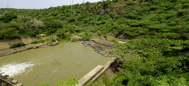
The following report presents the findings of the author’s research from May to August 2017 with support from the International Federation of Red Cross and Red Crescent Societies; Ministry of Water, Irrigation and Electricity – Ethiopia; Ethiopian Red Cross Society; and Red Cross Red Crescent Climate Centre (Climate Centre). The study area was Koka Dam and its downstream communities, located in the Oromia Region of Ethiopia. The study’s objectives were to (1) identify forecasts of natural phenomena that can help anticipate flood events; (2) assess what is known and what needs to be known to link forecasts with anticipated impacts; (3) suggest actions worth taking as soon as the forecast exceeds a predefined threshold of risk; and (4) outline proposed next steps for a forecast-based contingency plan. The author used the flood modelling software HEC-GeoRAS and community assessments iteratively to achieve the objectives.
Flood modelling was performed using HEC-GeoRAS, a software developed by the United States Army Corps of Engineers. The program allows users to view modelling results geospatially to determine the extent of flooding along a river or stream. The results from the HEC-GeoRAS analysis showed that agricultural land is the most vulnerable area to flooding. Therefore, minimizing flood impacts would improve the livelihoods of the agricultural workers living alongside the river by reducing damage to their land.
Following preliminary flood modelling, community assessments were performed in seven communities and two facilities downstream of Koka Dam. Focus groups were organized to elicit information. The results of the assessments showed that each community and facility suffers from flooding. The primary consequence of flooding is the destruction of agricultural lands, which confirmed the modelled results. Farming is the primary income-generating activity in the interviewed communities, and communities expressed a strong desire to improve flood management to improve their earning capacity. In addition to loss of income, communities reported an increase in the number of malaria and acute watery diarrhea cases following floods. Minimizing flood impacts can improve the livelihoods and health of the communities living downstream of Koka Dam.
Perceptions on the existing early warning system (run by the Awash Basin Authorities) were also elicited from community assessments. Communities are notified via media (e.g., television, radio) about scheduled releases from Koka Dam, while Sodere and Wonji are notified via phone calls and in-person meetings. Suggestions from communities for improving the existing warning mechanism included in-person notification, mobile phone calls, SMS messages, or notification of local irrigation officers. Representatives from Sodere and Wonji were satisfied with the existing warning mechanisms. Suggestions from communities, Sodere, and Wonji to improve the existing warning content included earlier warnings and details on the predicted impacts of flooding.
Recommended next steps for the project include exploring the feasibility of FUNES implementation and continuously engaging with the project’s stakeholders. FUNES is a self-learning algorithm software for hydropower dams developed by the Climate Centre. It was successfully piloted in Togo in 2016. The software uses hydrologic and precipitation data to improve flood predictions and the timing of controlled releases to minimize flood impacts to downstream communities of hydroelectric dams. The existing mechanism for controlled releases from Koka Dam is to simply release water from the reservoir when it reaches a certain level, and the downstream communities suffer from regular inundation of agricultural lands. In the future, FUNES could be implemented to better time controlled releases to minimize flood impacts and improve livelihoods in these communities. To ensure the successful implementation of the software, the project’s stakeholders should remain continually engaged. The project stakeholders include both government organizations and Red Cross affiliates. Read more …


Flood Modelling and Assessments for Downstream Communities of Koka Dam, Ethiopia
Prepared by Katherine Chambers
2017 Red Cross Red Crescent Climate Centre Internship Winner
Katie is a PhD student in Environmental Engineering with a focus on Engineering for Developing Communities. In Ethiopia, Katie developed flood inundation maps for communities downstream of hydroelectric dams. These maps will guide the development of Early Warning Early Action frameworks for the Ethiopian Red Cross Society and IFRC. Her environmental engineering research investigates the comparative vulnerabilities and resilience of different types of sanitation systems found in resource-limited communities, as well as the tradeoffs made when prioritizing resilience in system selection.
The following report presents the findings of the author’s research from May to August 2017 with support from the International Federation of Red Cross and Red Crescent Societies; Ministry of Water, Irrigation and Electricity – Ethiopia; Ethiopian Red Cross Society; and Red Cross Red Crescent Climate Centre (Climate Centre). The study area was Koka Dam and its downstream communities, located in the Oromia Region of Ethiopia. The study’s objectives were to (1) identify forecasts of natural phenomena that can help anticipate flood events; (2) assess what is known and what needs to be known to link forecasts with anticipated impacts; (3) suggest actions worth taking as soon as the forecast exceeds a predefined threshold of risk; and (4) outline proposed next steps for a forecast-based contingency plan. The author used the flood modelling software HEC-GeoRAS and community assessments iteratively to achieve the objectives.
Flood modelling was performed using HEC-GeoRAS, a software developed by the United States Army Corps of Engineers. The program allows users to view modelling results geospatially to determine the extent of flooding along a river or stream. The results from the HEC-GeoRAS analysis showed that agricultural land is the most vulnerable area to flooding. Therefore, minimizing flood impacts would improve the livelihoods of the agricultural workers living alongside the river by reducing damage to their land.
Following preliminary flood modelling, community assessments were performed in seven communities and two facilities downstream of Koka Dam. Focus groups were organized to elicit information. The results of the assessments showed that each community and facility suffers from flooding. The primary consequence of flooding is the destruction of agricultural lands, which confirmed the modelled results. Farming is the primary income-generating activity in the interviewed communities, and communities expressed a strong desire to improve flood management to improve their earning capacity. In addition to loss of income, communities reported an increase in the number of malaria and acute watery diarrhea cases following floods. Minimizing flood impacts can improve the livelihoods and health of the communities living downstream of Koka Dam.
Perceptions on the existing early warning system (run by the Awash Basin Authorities) were also elicited from community assessments. Communities are notified via media (e.g., television, radio) about scheduled releases from Koka Dam, while Sodere and Wonji are notified via phone calls and in-person meetings. Suggestions from communities for improving the existing warning mechanism included in-person notification, mobile phone calls, SMS messages, or notification of local irrigation officers. Representatives from Sodere and Wonji were satisfied with the existing warning mechanisms. Suggestions from communities, Sodere, and Wonji to improve the existing warning content included earlier warnings and details on the predicted impacts of flooding.
Recommended next steps for the project include exploring the feasibility of FUNES implementation and continuously engaging with the project’s stakeholders. FUNES is a self-learning algorithm software for hydropower dams developed by the Climate Centre. It was successfully piloted in Togo in 2016. The software uses hydrologic and precipitation data to improve flood predictions and the timing of controlled releases to minimize flood impacts to downstream communities of hydroelectric dams. The existing mechanism for controlled releases from Koka Dam is to simply release water from the reservoir when it reaches a certain level, and the downstream communities suffer from regular inundation of agricultural lands. In the future, FUNES could be implemented to better time controlled releases to minimize flood impacts and improve livelihoods in these communities. To ensure the successful implementation of the software, the project’s stakeholders should remain continually engaged. The project stakeholders include both government organizations and Red Cross affiliates. Read more …