
Polarstern in Aug 2011 (Credit: Mario Hoppmann, Alfred Wegener Institute)
20 September 2014, by Dan Wolfe:
Yesterday we has some scientists from the German icebreaker, Polarstern, fly over in their helicopter to the Oden. I told you there was more going on up here than one would imagine. I heard about the visit over breakfast from one of our scientists who is from Germany, has been on the Polarstern, and had a friend he was communicating with. It was an exciting time and we knew they were in the area. If you remember from an earlier blog I mentioned the Polarstern had been close to the pole. It was exciting to see their ship off in the distance and then follow the helicopter through binoculars as it approached the Oden. I’ve been lucky enough to experience this when I flew out to the icebreaker I was on by helicopter in Nome, AK after attending Naval Underwater Diver’s School in Key West, FL.
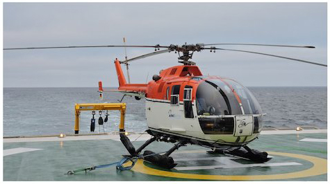
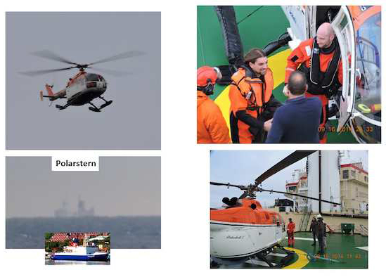
Visitors from the Polarstern
The main purpose of this trip had to do with the ocean bottom mapping we are doing. The Polarstern has mapped this same area before, but the Oden has a new and very sophisticated multi-beam sonar that can map the bottom in detailed 3-D. This instrument is starting to be used all over the world and is capable of showing in great detail features on the bottom and in the water column. On the cruise we are interested in finding seeps, evidence of glacial activity, and in general mapping the depth of the ocean. Seeps are essentially bubbles released from melting permafrost on the bottom of the ocean and are believed to be methane. Another feature that is proving to be very exciting to our chief scientist is finding scouring on the ocean bottom made by glaciers from previous ice ages. This information along with the water and bottom coring samples will help them understand what may have happened many years ago. Mapping of the ocean depth is important for two reasons. Scientifically we are gathering data in regions where there may be none or verifying and improving previous results. Right now we are mapping the Lomonosov Ridge. This is a feature in the Arctic Ocean that extends from the Continental Shelf out nearly to the North Pole. Our main interests are how this ridge affects the circulation in the Arctic. How deep is it and how many cuts are in it that might allow water to flow from one basin to another? This circulation is connected to the world’s oceans circulation and climate. This becomes interesting for political reasons too as the Russians are claiming this ridge extends their Exclusive Economic Zone (EEZ) out to the North Pole. If in fact there are cuts in the ridge it may no longer qualify as an extension of their EEZ. This is not our place to say one way or the other, but has been in the news and therefore something we talk about amongst ourselves.
I hope you’ve enjoyed our blog as much as I’ve writing it. We are all getting stir crazy and ready to head home. For the last several days we’ve been above 85N, which puts us very close to the North Pole and we can almost see Santa’s workshop! It has also reduced our ability to communicate with the outside world. The communication satellites are right at or below the horizon at this latitude. We are expecting a rough ride home through the Barents Sea and will be securing everything that isn’t already over the next couple of days. Meteorologically we would like to keep sampling the atmosphere on our way back including launching balloons. This may become too dangerous and we’ve been told if it gets too rough no one will be allowed on the outside decks. Also because our container where we prepare the radiosonde sits on top of the bridge it is affected even more by the rolling of the ship and quite unsafe. What we do for science!
One more item before I sign off. Did you ever wonder how clean the air is in the Arctic? We hear about man’s pollution making it all the way to the Arctic. Well the other day we noticed we couldn’t see our breath even though it was -5C (23F). The reason is the air is very clean and lacking any small particulates that the moisture from our breath can condense on. As we walk around the outside of the ship and pass by any of the exhaust vents coming from inside the ship you will see your breath then. For example the exhaust from the kitchen has enough particulates to collect allow us to see our breath. I’ve heard about this before from co-workers who were on the Oden in 2008. In fact they made a video of this you might be able to find on the web somewhere. What would be fun is if I can use the IR camera to capture this. I need to plan it out more though. My first attempts have not been totally successful. Seeing your breath with the IR camera probably won’t work, but the same idea is possible using a “Steaming” hot drink. Wish me luck!