
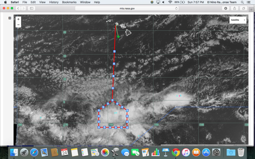
HONOLULU, HAWAII — The NOAA G-IV launched from Oahu at 11:32 Hawaii Time for a 7.5-hour trip and is on a trajectory to fly south of the equator and release 26 dropsondes while circuiting a large mesoscale convective complex (that’s a large, circular, long-lived cluster of showers and thunderstorms identified by satellite, often emerging out of other storm types during the late-night and early-morning hours). The flight plan provides more details.
I’m part of the science team that will be actively monitoring the convective activity and lightning strikes along the flight track today and providing guidance to the Flight Director in real time, thanks to MTS capabilities (NASA’s Airborne Science Program’s Mission Tool Suite (MTS) is an online tool used to plan and track the flights).
The pilots will have a major decision point at the northeast corner of the pattern, when they will make the call whether to fly south of the convective line, currently oriented from ENE to WSW near 2.5N, 155.5W. If they decide that they can’t proceed south, they will then complete as much of the flight plan as feasible north of the line to sample poleward divergent outflow (winds flowing poleward divergent to those flowing latitudinally).
Looking ahead to Research Flight 3 tomorrow, we are planning to sample a convective complex forecasted mostly due south of Hawaii and a few degrees north of the equator. The more northward flight pattern will enable us to complete a broader east-west survey along the zonally oriented convection.
Prospects for additional research flights later in the week continue to look promising, and we’ll evaluate those on subsequent briefing cycles.