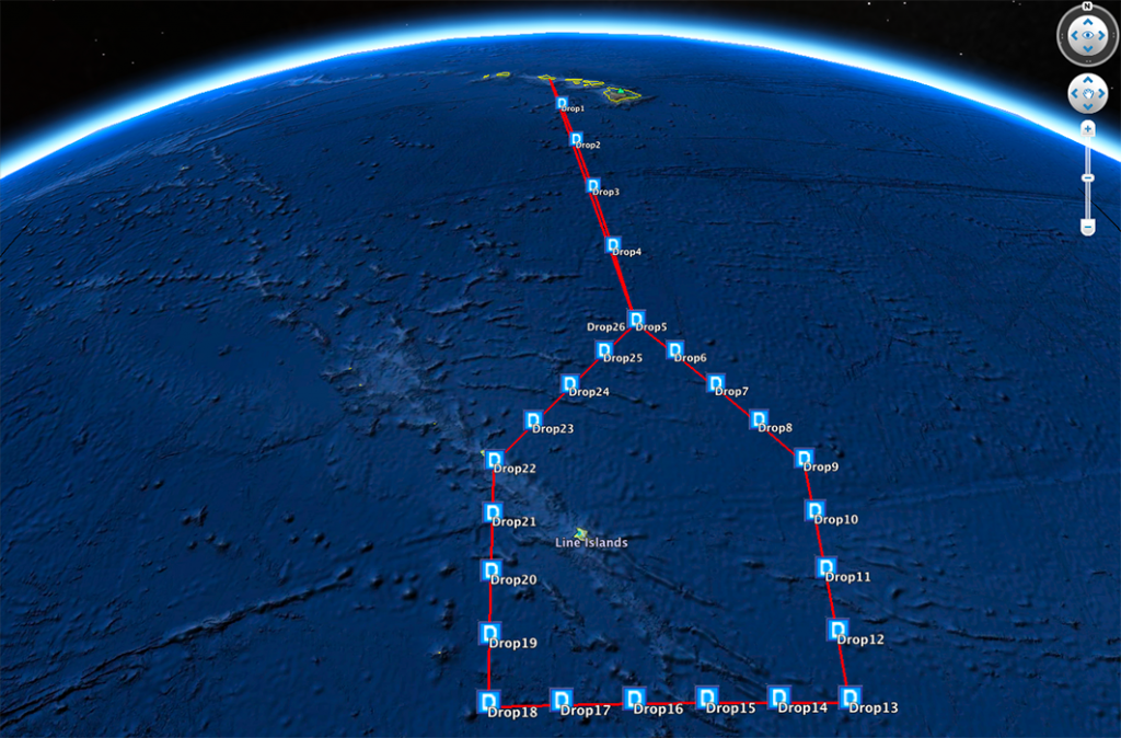
Planned flight track and drop locations for the NOAA G-IV on January 21st.
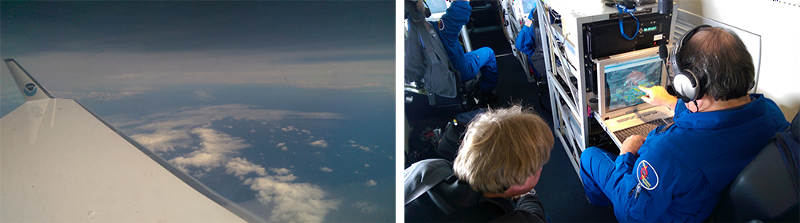
HONOLULU, HAWAII — Here’s a brief report from the air, on the first research flight of the El Niño Rapid Response Field Campaign. I’m on the NOAA Gulfstream-IV aircraft, which will fly out of Honolulu carrying a suite of meteorological sensors and deploying dropsondes on about 20 research flights through early March.
The first flight is going very well. This image shows the flight plan, with the planned track and drop locations. The first dropsonde deployment at 11:26 am Hawaii Time was textbook, with readings indicating extremely low humidity and a dry adiabatic profile characteristic of strong subsidence (for you non-scientists: this means the air was very dry and had clearly dropped down from higher, colder and drier altitudes). We entered a hazier, diffuse cirrus with scattered to broken cumulus and stratocumulus clouds around noon, likely reflecting outflow from convection (translation: major movement of air upwards, often preceding storms) much farther to the west/southwest. I expect a left hand turn to enter the “house” profile within the next few minutes, based on rough estimates I have from the flight plan.
A quick update: we will be dropping the last sonde shortly, and will request a 360 turn at cruise altitude to ensure we capture all the data. We will also request to stay high as long as air traffic control allows, to allow sufficient time for the sonde to reach the surface. The flight plan puts us back on the ground around 6:30 Hawaii Time, but it may be a little later after the short hold. I believe we’re just around the last northern band of high cloud (some lower stratocumulus), likely an outflow from convection further southwest.