NOAA & NASA: Partners on the cutting edgeFebruary 8, 2016by Theo Stein (NOAA)
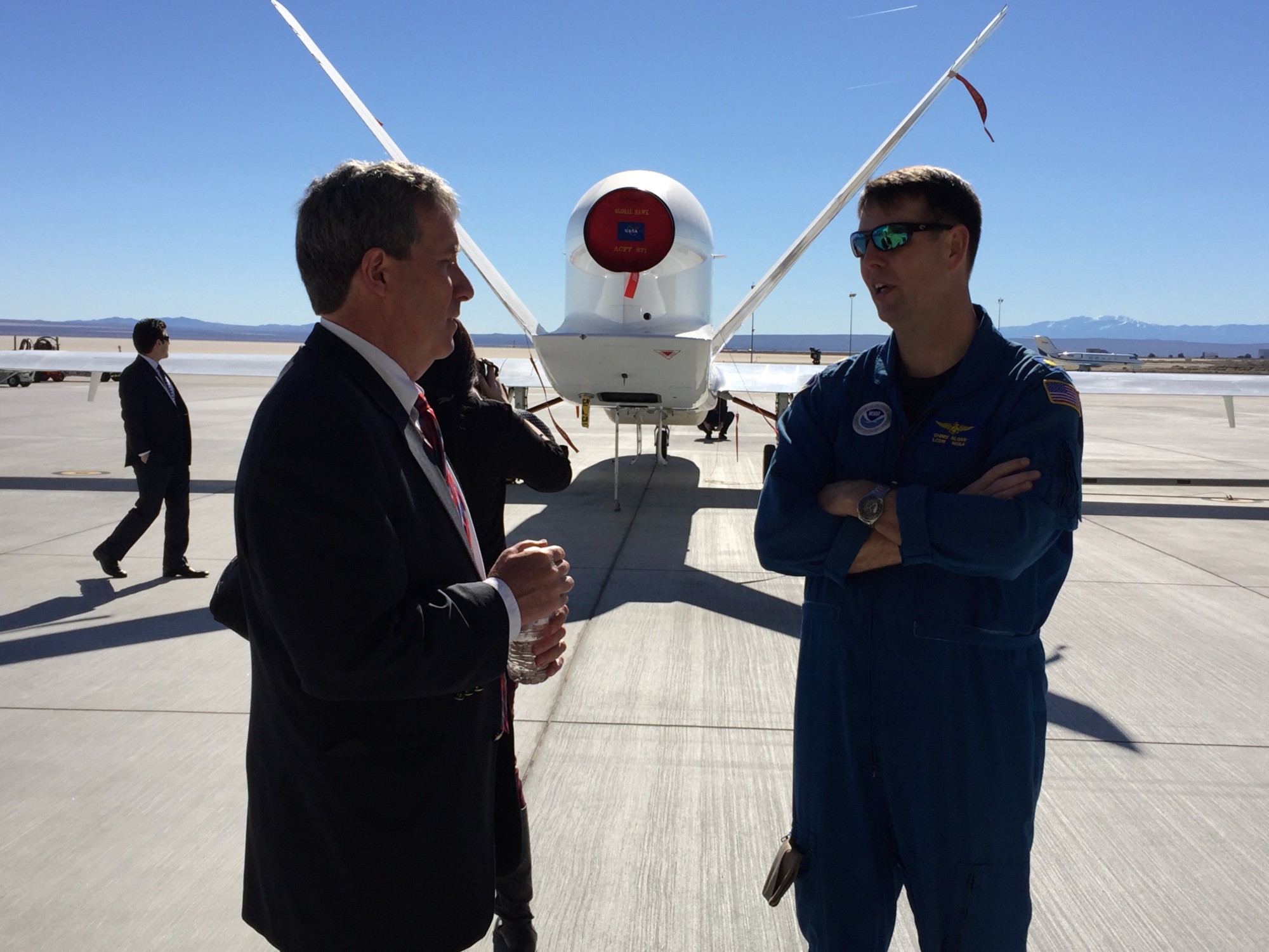
 Robert Webb, director of NOAA ESRL’s Physical Sciences Division, chats with mission specialist Chris Sloan while the Global Hawk waits for its first flight of the El Nino Rapid Response field campaign.
NOAA & NASA: Partners on the cutting edge
February 8, 2016by Theo Stein (NOAA)
EDWARDS AIR FORCE BASE, California — NASA’s Armstrong Flight Research Center fairly drips with history.
For more than half a century, NASA scientists here in California’s arid Antelope Valley have developed, tested and deployed the technologies that lifted aviation to new heights.
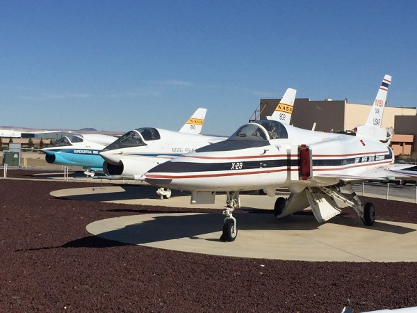 A row of retired research planes, including the radical X-29, with its forward-swept wing, on display outside NASA’s Armstrong Flight Research Center.
Chuck Yeager flew here. Neil Armstrong walked the flight line. More than 50 successful space shuttle missions have concluded here, their sonic booms echoing over the desert and neighboring Edwards Air Force Base to herald their descent to the dry lake bed.
On February 5, California media gathered to learn about a NOAA-led mission to study the heart of El Niño, the recurrent Pacific ocean warming phenomenon that disrupts weather around the globe. A key element of the mission is a NASA-NOAA partnership exploring the next cutting edge in aviation — unmanned aircraft systems — and how they may one day help improve weather forecasts across the globe.
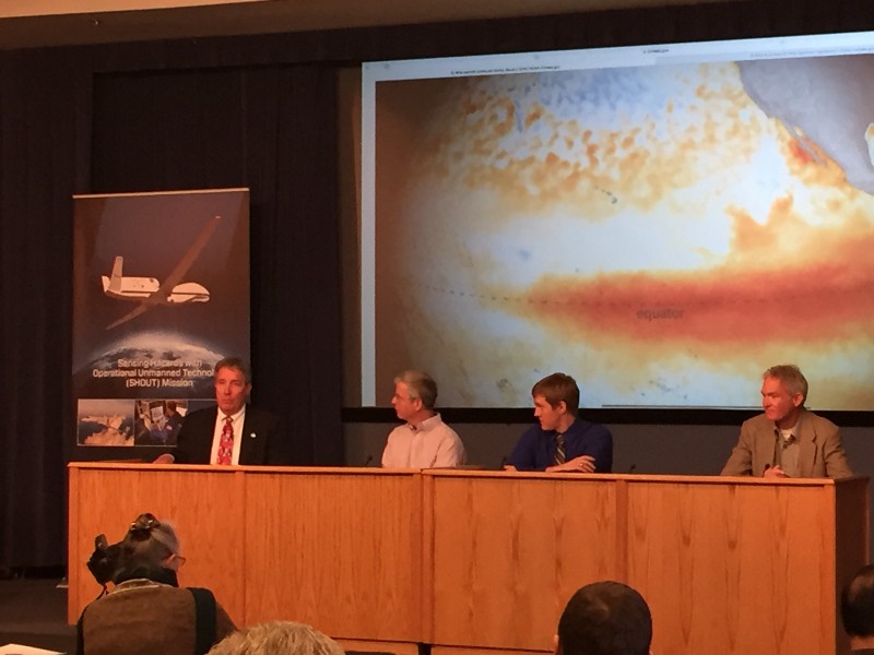 Robert Webb (Director, NOAA ESRL Physical Sciences Division), Gary Wick (Co-Project Scientist, NOAA ESRL PSD), Jason Sippel (NOAA/NWS Environmental Modeling Center scientist), and Frank Cutler (Project Manager, NASA Armstrong Global Hawk) answer questions from the media.
This month, NASA’s Global Hawk drone is set to head to the eastern Pacific to gather data on El Niño-spawned weather systems as they approach the U.S. West Coast. It’s part of NOAA’s El Niño Rapid Response Field Campaign, a land, sea, and air campaign to study the current El Niño in an effort to improve weather forecasts thousands of miles away. The fully autonomous Global Hawk, directed by pilots in a control center here, can cruise for up to 10,000 nautical miles at elevations of to 60,000 feet, potentially filling a niche between piloted craft and satellites.
NOAA researchers and colleagues from CIRES and elsewhere will gather data from four kinds of instruments. Dropsondes, deployed from the aircraft in flight, will measure air temperature, humidity, and wind speed. NASA’s High Altitude Imaging Wind and Rain Airborne Profiler (HIWRAP) and the High Altitude MMIC Sounding Radiometer (HAMSR) capture data similar to satellite observations. Finally, a NOAA instrument will sample ozone concentrations along the flight path.
“This is the first time the process has been automated.” Robbie Hood, Director of NOAA’s Unmanned Aircraft Systems program.
If the research effort is successful, unmanned aircraft could become a common tool in supporting weather forecasts in the years to come.
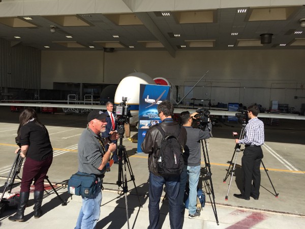 TV crews prep for an interview with Northrop-Grumman project manager Mike Lyons. The California defense contractor developed the Global Hawk and donated the first two production models to NASA for research.
As the television crews examined the aircraft and conducted interviews, a pair of sonic booms rattled the hanger area — courtesy of a fighter from next-door Edwards Air Force Base on a training run.
Meanwhile, scientists were keeping an eye on the eastern Pacific, waiting for a weather system for the Global Hawk to chase. It was just another day on the cutting edge.
By CIRES on February 8, 2016.
Exported from Medium on January 12, 2017.