Community day allowed for a lot of exciting teams to showcase their UAS and talk about the different objective they are pursuing. Throughout the day on Community Day, I was able to wander from team to team and ask a little about their drones and planes. Most of the teams I asked were with the Collaboration Leading Operational UAS Development for Meteorology and Atmospheric Physics (CLOUD-MAP). The teams in CLOUD-MAP were: Oklahoma State University (OSU), the University of Kentucky (UK), the University of Nebraska, Lincoln (UNL), and the University of Oklahoma (OU). Together, the universities plan to produce small unmanned aircraft systems (SUAS) with the ability to perform meteorology and atmospheric physics measurements.
Initially, I wandered towards the OSU team’s booth. There, they displayed a collection of SUAS and UAS. The drone they presented held an anemometer mounted that would produce turbulence measurements. Specifically, the device measured wind speed and GPS position to reduce uncertainty in measurements from the drone’s movements. Moreover, the team showcased a UAS looking like a small version of a plane that would make measurements with regards to ice accretion. This was part of a project ran by an OSU graduate student working on her PhD.
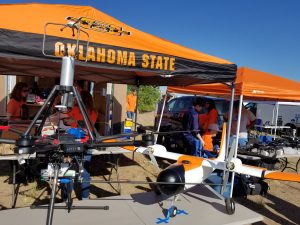
Anemometer mounted on a drone (left) and Icing Project UAS (right) – OSU
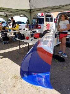
Meanwhile, the University of Kentucky also displayed three different UAS models for CLOUD-MAP. The first two that Harrison Wight, a graduate student at UK, spoke with me about were turbulence measurements devices. Both UAS made use of GPS differentiation, which allows for high-accuracy location measurements, including information about the orientation and horizontal movements of the drone. These calibrations are necessary in order to determine precise wind speed measurements from the raw wind data collected. The previous version (shown below) of the UAS was made with a styrofoam body, lessening its weight. Additions made to the current version are increased flight time and a carbon fiber body.
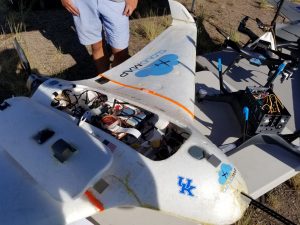
Previous Blue Cat model – UK
Current Blue Cat model (6th generation) – UK
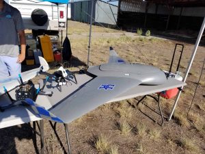
Moreover, the University of Kentucky also had a SUAS measuring atmospheric chemistry (displayed below). The main purpose behind the identification of chemical measurements is to paint a macroscopic atmospheric environment from gathered microscopic environmental information. This specific SUAS had a 3D printed case holding all meteorological sensors, such as a CO2 sensor, that was designed by one of the students on the UK Team.
Chemical measurements SUAS – UK
Although separate from CLOUD-MAP, CU Boulder’s Integrated Remote & In Situ Sensing (IRISS) program is also involved in LAPSE-RATE operations. The team had set out a variety of their UAS, including a 15-foot wingspan plane weighing up to 50 pounds (below). This device had movable parts in its housing, allowing for more space if need be, depending on particular flight objectives.
15-foot wingspan on UAS – IRISS
IRISS was also working on perfecting a small instrument suite that could be independent of the UAS, making it removable. This project was implemented with an older UAS called Twister, and is still currently in its development stage. IRISS mentioned that one client for the product already is UEE (Unit Electrical Engineering).
More to come!