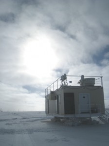
 With most of our instruments now installed, we’ve focused on the details…. Tuning up the instruments, making them all talk with each other via the network, moving data files around and making sure they are archived, and evaluating data quality. Two days ago we had an ICECAPS team meeting and starting putting together a list of things that still need to be done, and it was a very long list! Glad I still have more than a week here at Summit, and I’m thinking that some of the last details will be handled remotely after getting home.
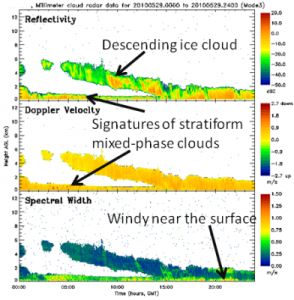
During th e last couple of days we’ve had a great stratiform cloud layer, mostly overcast with occasional breaks. And almost continuous, but light, precipitation of ice crystals. The cloud view from the radar is shown to the left: Multiple cloud layers over the course of yesterday, up to altitudes of 6 km. But the most notable feature is the persistent, low-level stratiform mixed-phase cloud with signs of in-cloud turbulent motions. While our time at Summit has been rather short, and we only have a couple day’s worth of data thus far, I’d say that the clouds we’ve observed here are not too different from those that I’ve seen at other Arctic observatories in Barrow, Eureka, and over the Arctic Ocean. Can’t wait to observe the seasonal evolution of clouds at this site!
