Week 2 – let the research begin! The past five days consisted of meeting my hardworking computer (whose preexisting name, let the record show, is Halibut), practicing with photogrammetry software, and working through lessons on Unix, command line, Git, and Python. My mentor, Katy, attended a remote sensing conference; there were a few workshops on measuring topography with UAS (drones) as well as on Agisoft, the photogrammetry software we are using. A lot of new information to digest, but I really enjoy it and am so happy to have started my project! This coming Monday will be my first day in the field; we are hoping to beat the rain and head down to the Chalk Cliffs to fly the drone! After working out some kinks with the camera and the processing system from a previous flight, I’m looking forward to getting some new images and beginning my research. Which, if I haven’t mentioned, is to try to find an ideal number and distribution of ground control points (physical markers spread along the cliffs) that maximize the accuracy of the topography in our 3D models while minimizing the amount of points needed.
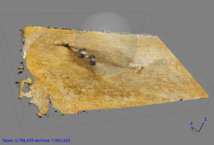
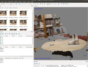
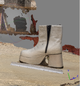
The highlight of my week was definitely playing with Agisoft and making practice models – everything was fair game in the office, from clothespins and dinosaurs to people’s faces. All of these models were, I would say, unsuccessful – comically so (photos below). However, perseverance paid off! Only one object hadn’t been tried: a glistening pair of 1970s disco boots, an office mascot sitting on a shelf since The Day Disco Died (not really, but… they’re old). After a week of toiling in vain, these boots, a tongue-in-cheek farewell gift to a vertically-challenged colleague, were just waiting to unleash the power of disco. Needless to say, the boots did the trick (along with some program adjustments, but hey, let’s not spoil the moment) and a rather fetching 3D model was created! Celebrations were had, posters and disco parties are in the works; it was a great office bonding moment.
Until next time!
Jess


