I joined EarthScope investigators Christine Siddoway and Megan Anderson (Colorado College) and Eric Erslev (University of Wyoming) on a 4-day structural geology tour of the Bighorn Mountains in northern Wyoming. A group to be led by Megan will install seismic stations throughout the range this summer as part of the Foreland Basement Arch Seismic Experiment. Christine and Eric have students starting fieldwork in the Bighorns for structural geology theses. For all who are involved in the work this summer, the field trip provided an introduction to the regional geology of the Bighorns basement arch.
6/22/09
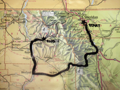
Out route through the Bighorns
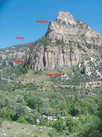
Out of Buffalo we followed Highway 16 to view the Clear Creek Fault, the structure that bounds the Bighorns Arch on the east. Before exiting the vehicles, Eric equipped us with a sheet showing the stratigraphic column of the Bighorns, which became tattered and discolored after a day of constant referral. Resiliently (and to my dismay) we trudged up the highway into a strong head wind evading zooming vehicles along the way. Beginning with the Madison Limestone, each rock formation was marked by a sign (common throughout the Bighorns). In order followed the Bighorn Dolomite (Ordovician) and Gros Ventre Shale Formations (Cambrian).
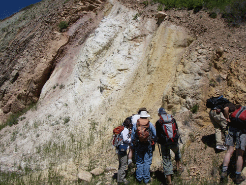
The crew inspecting the Gros Ventre Fm.
Following the structural geologists’ lead, I oh and ah’ed over the formations and watched each of them scribble ardently in their notebooks, fuss with compasses and hammer at the rock, BUT I couldn’t help thinking, what’s all the fuss about? Boy was I enlightened. The lesson of the day, and essentially the credo of geologists is that while we enjoy the landscape that surrounds us, it’s what lies beneath the face value, rather the architecture of the rock formations and the evolution of forces that shape the surface of the land that are worth the ohs and ahs.
Let me begin.
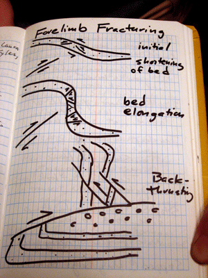
From the Madison through the Gros Ventre, the bedding is almost completely vertical. Also, with increasing elevation, the formations become older. So what occurred in geologic history that caused this deformation? Fault bend folding!
Eric explains the basic principles of folding in the following video.
[youtube]http://www.youtube.com/watch?v=gLsZe2w8878[/youtube]
Leaving the road cuts behind we made our way into the heart of the Bighorns and ate lunch with a view.
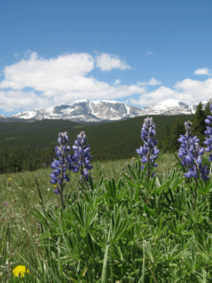
- Lunch in the Bighorns
At our next stop in the Bighorn Stratigra-tour, the Cambrian Flathead Sandstone, we stumbled upon the Great Unconformity! Entering the canyon, the backlimb of the fold came into view and we were able to identify the majority of the stratigraphic column through the Paleozoic. We also explored Eric’s model explaining the deformation of the Bighorn range coined rotational fault bend folding. This hypothesis explains the features observed in the crust better than prior hypotheses such as kink bend folding (as Eric explains in video #2).
[youtube]http://www.youtube.com/watch?v=lOwdW0bcbQ8[/youtube]
- Tensleep Canyon

Chris's "Orientator"
The Earthscope Bighorn Mountains project aims to unify this model of upper crustal structures with lithospheric scale structures through the Foreland Basement Arch Seismic Experiment.