Following our storm last weekend the weather in McMurdo improved for a few days allowing Kara and I to do some drone flights and collect the data we need for our research. In this blog post I’ll discuss previous drone-based research my research group has done in Antarctica, and the Arctic, before showing a few photos and some data from the drone flights Kara and I have been doing on our current trip. You can read more about my previous trips on my blog at https://ciresblogs.colorado.edu/antarcticuavs/.
My research group started using drones, or more formally uncrewed aerial systems (UAS), in September 2009. At the time we were the first U.S. research group to do drone flights in Antarctica and along with scientists from the British Antarctic Survey were the first groups to do drone flights in Antarctica. For my fieldwork in 2009, and again in September 2012, we contracted with an Australian company, Aerosonde, to provide drones, pilots and engineers to do the drone flights while myself and members of my group directed the flights.
The Aerosonde was a relatively large UAS that weighed 40 pounds and had a wingspan of almost 12 feet. To launch the Aerosonde we mounted it on a rack on a pickup truck and then had to drive the pickup truck at 50 mph to generate enough lift for the Aerosonde to take off. In this photo the Aerosonde UAS has just lifted off from the rack on the pickup truck.
For our 2009 and 2012 Aerosonde field campaigns we flew the drones 200 miles north of McMurdo to Terra Nova bay, on the coast of the Antarctic continent. These drone missions lasted up to 20 hours. We used an Iridium satellite modem to get real-time data and flight status from the Aerosonde during these long missions. Our research goal for this project was to study how the strong winds, sometimes exceeding hurricane strength, blowing off the Antarctic ice sheet impacted the sea ice and ocean at the edge of the continent.
Starting in 2012 I began using a much smaller, fixed wing drone called a SUMO (Small Unmanned Meteorological Observer). The SUMO was built from a commercially available hobbyist remote control plane that was fitted with an autopilot and weather sensors. The SUMO was much less expensive and much easier to fly than the Aerosondes. Most importantly the SUMO was small enough that we could take it to remote field camps to do flights without the complex logistics that the Aerosonde required.
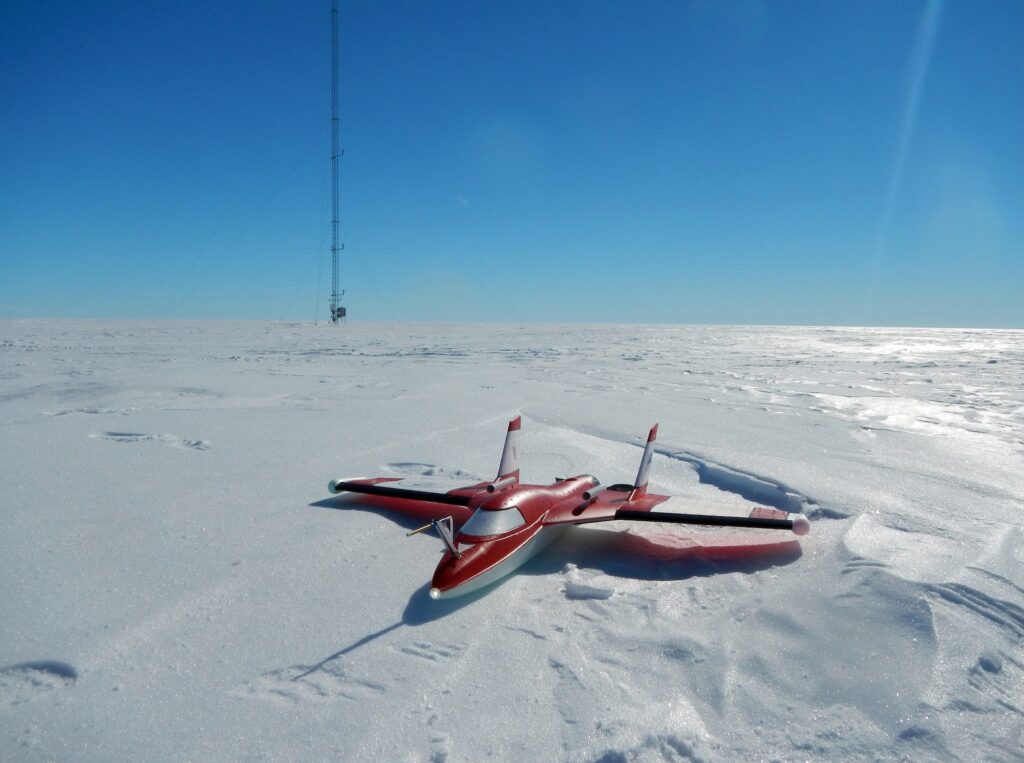
In January 2014 myself and a graduate student in my group, Melissa, spent two weeks camping on the Ross Ice Shelf, about 100 miles away from McMurdo Station, using SUMO drones to make measurements of the lowest 3,000 feet of the atmosphere. In this photo the SUMO is sitting on the ice shelf in front of a 100 foot tall automatic weather station.
The SUMO was a great drone platform for our research needs, and we used it in 6 different Antarctic field campaigns from 2012 to 2017. The SUMO allowed us to make measurements of the lowest part of the atmosphere, called the boundary layer, so we could understand how turbulence and mixing exchange heat and moisture between the snow surface and the atmosphere. We used this data to evaluate and improve how Antarctic weather forecasting models represent boundary layer processes.
In early 2020 I took part in a large international Arctic research expedition called MOSAiC (Multidisciplinary drifting Observatory for the Study of Arctic Change). This expedition froze a German icebreaker into the sea ice north of Russia in October 2019 and allowed the ship to drift across the Arctic, with the sea ice, for an entire year. Myself and one of my graduate students, Gina, did drone flights with a fixed wing UAS called a DataHawk2 to study the Arctic boundary layer. This research was similar to the work I had done in Antarctic with the SUMO drones.
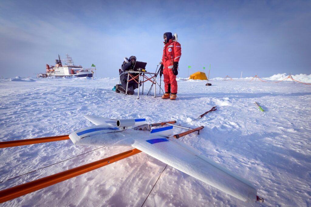
Gina and I preparing a DataHawk2 for a research flight over sea ice in the Arctic Ocean. The German icebreaker Polarstern is visible in the background. The icebreaker was our home for more than 2 months in March and April 2020 as the world descended into lockdowns because of COVID. (photo by Delphin Ruché)
During our current Antarctic trip Kara and I are using a quadcopter drone, called a Parrot Anafi, to make temperature measurements in the lowest 600 feet of the atmosphere over the Ross Ice Shelf. The research we are doing is similar to that of my previous drone field campaigns. We are using the drones to observe how temperature changes as you move up away from the ground through the atmosphere.
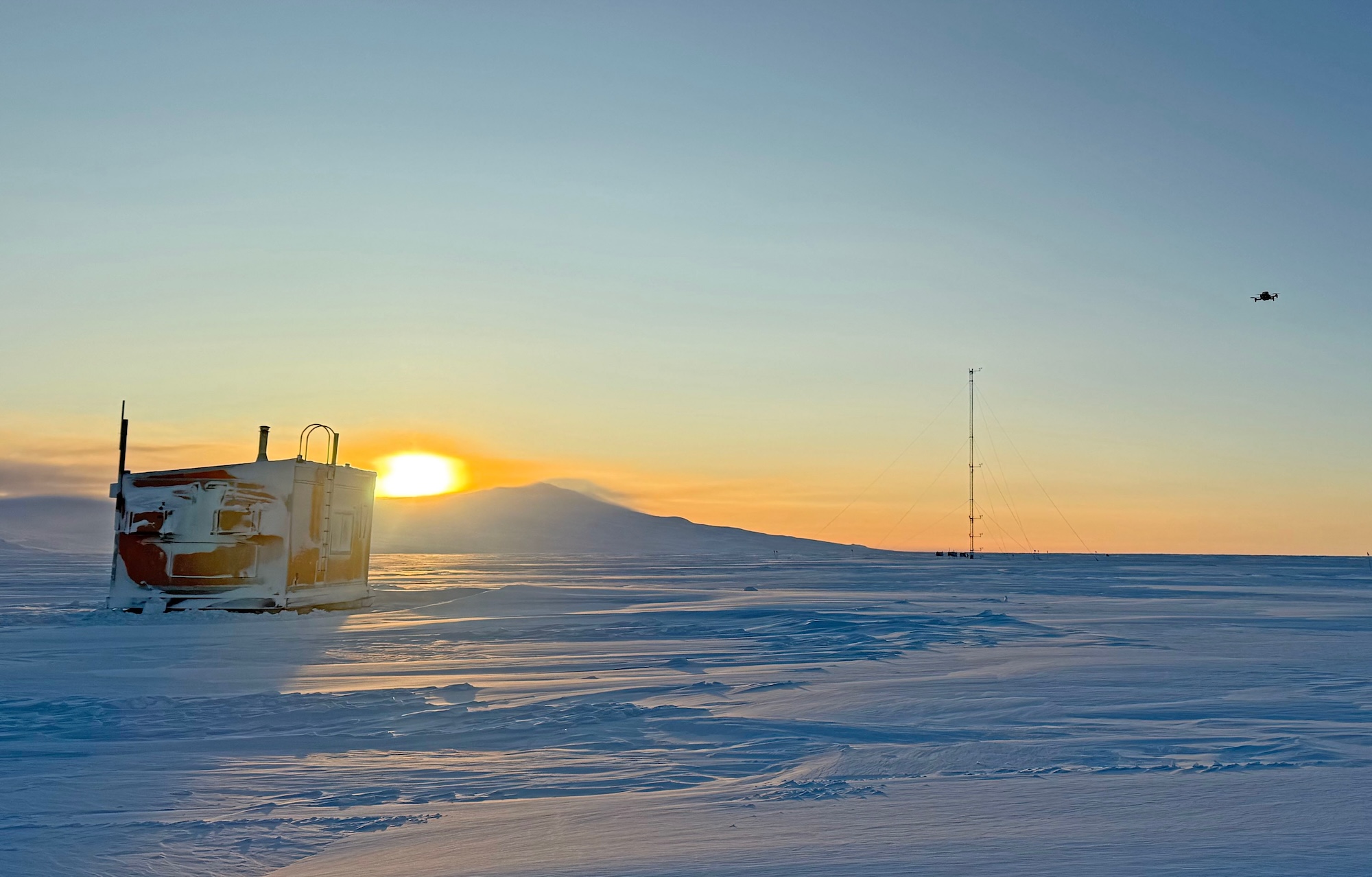
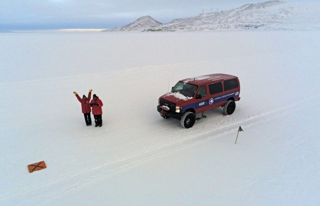
The Parrot Anafi is a small quadcopter drone. We have attached a meteorological sensor to the top of the drone using foam and Velcro, since adhesives like glue or tape are unreliable at the very cold temperatures we are experiencing at the end of the Antarctic winter. The sensor measures atmospheric temperature, humidity and pressure and lets us see how atmospheric conditions change as we move up away from the snowy surface of the ice shelf. A 100 foot tall automatic weather station and the hut we are using as a base for doing our work are visible in the background of this photo.This graph shows temperature measurements (blue dots) made with the sensor mounted on the Parrot quadcopter. The temperature goes from -40 F to -20 F moving from left to right on this graph. Altitude increases from ground level (0 feet) to 300 feet as you move up on the graph. On this day the temperature at the ground (bottom left of graph) was around -38 F. Over the lowest 50 feet of the atmosphere the temperature warmed by over 14 degrees, to -24 F (the string of blue dots lined up almost horizontally). When temperature increases with height in the atmosphere this is referred to as a temperature inversion, and we are interested in studying the strong temperature inversions that occur in Antarctica at the end of winter because they limit how much heat and moisture is exchanged between the Antarctic ice sheet and the atmosphere. Above this very strong, shallow temperature inversion the temperature is nearly constant with height (blue dots lined up almost vertically) up to 250 feet. The asterisks on this graph show temperature measured by the 100 foot tall tower weather station.In this photo you can see the Parrot drone in flight (on the right side of the image) as the sun rises behind the volcanic peaks of Ross Island. You can also see the weather station tower and hut in this photograph.The Parrot quadcopter is equipped with two cameras – one that takes regular photographs and videos and another that takes thermal infrared images. In this drone selfie Kara and I are watching as the Parrot flies over the ice shelf. Scott Base, a New Zealand Antarctic station, is visible as the group of green buildings in the background just below the rocky, snow covered hills. McMurdo Station, where Kara and I are based, is just over the hills.The Parrot can also take 360 degree panoramic photos. This photo is showing part of a 360 degree panorama. You can see Kara and I standing by our van as we pilot the drone. Our hut and the tall tower weather station are visible on the right side of this image. Ross Island, with the volcanic peak of Mt. Erebus, is visible in the background. On the far left side of this photograph the snowy peaks of the Royal Society Range are a pale orange in the light of the rising sun. These mountains are more than 60 miles away from us, across the frozen sea ice of McMurdo Sound.This is a thermal infrared image taken by the Parrot quadcopter. The blue to red colors in the center of this image show temperature measured by the IR camera. Blues show cold surfaces while yellow, orange and red are warmer objects. When we were doing this flight the temperature was around -15 F and the dark blue in the image shows the cold snow surface. Kara and I and our van are much warmer as shown by lighter blue to red colors. You can tell that our exposed faces are the warmest objects in this image by their red color. The light blue color of my hands show slightly cooler temperatures where I am wearing thin gloves that allow me to operate the drone remote control. Our torsos are a darker blue and this shows that our big parkas are insulating us from the cold air, trapping our body heat inside the jacket while the jacket surface is cold. Finally, you can see warm air blowing from the heater vents on the dashboard in our van.In this photo the camera on the Parrot quadcopter is looking straight down on us from several hundred feet above the ice shelf. The snow road we drive on is visible running from left to right across the image. You can also see our hut and where the wind has scoured snow from around the hut and created an oval ridge of snow dunes circling the hut.This thermal infrared image is the same view as the previous image, with the blue to red colors showing temperature. Our van (red) is the warmest object in this image. The hut is also warm with the side facing the sun (the left side of the hut in this image) being the warmest (yellow and red). The dark blue to the right of the hut shows that the snow here is colder than elsewhere because of the hut’s shadow. The dark blue extending up and to the left from the hut is showing an area of the snow surface that has been scoured by the wind and as a result is colder than much of the rest of the snow in this scene.This is another panoramic photo from the Parrot quadcopter. This panoramic image is artificially curved to show a wider view than the panorama above. In this photograph we are looking south, away from Ross Island, over the Ross Ice Shelf. Our van, hut and tall tower weather station are visible at the bottom of the image. The Royal Society Range is visible on the far right horizon. The conical mountain at about the 2 o’clock position on the horizon is Mt. Discovery while the flat expanse of the Ross Ice Shelf and a few gray clouds are visible across the rest of the image.
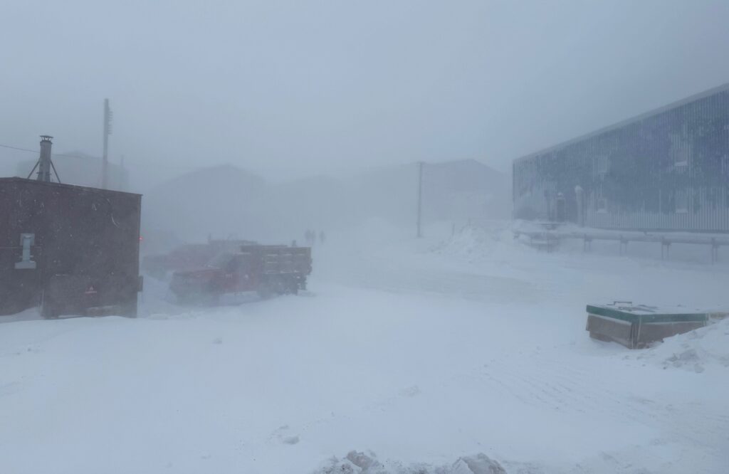
After a few days of doing drone flights in nice weather another storm arrived at the end of the week. Winds of more than 40 mph, with gusts to 85 mph, lasted from around midnight Friday until Saturday evening. During this storm the weather in McMurdo remained mostly condition 2, which meant we couldn’t leave town but could walk between buildings in McMurdo, except for a few hours of condition 1 weather overnight Friday night and again Saturday afternoon.
I took this photograph while walking from my office in the Crary science building to the blue dorm building on the right side of this image during condition 2 weather. You can see several dorms in the background, a few hundred feet away, just visible through the blowing snow.
It looks like we may get a few days of nice weather early this week before another storm rolls through mid-week. Hopefully we’ll be able to do some more drone flights before this next storm.
Thanks for reading.
One comment on “Drones”
Hi John. Thanks for sharing, every thing is so interesting, I hope you had some good weather.






Hi John. Thanks for sharing, every thing is so interesting, I hope you had some good weather.