Two days ago I arrived in Nuuk, Greenland to meet the Research Vessel (R/V) Knorr to participate in the cruise experiment HiWinGS, which stands for High Wind Gas Exchange Study. This study takes place in the North Atlantic Ocean from October 9th to November 15th, 2013. The project focuses on improving our understanding of how gas moves between the atmosphere and the ocean surface (exchange) in high wind conditions. The eventual outcome of the experimental effort is an improvement in gas exchange parameterizations (models) which will help better predict our future climate.
So why go to this part of the world? Well in this region, we have more chance to find all the good ingredients we need to be successful in our mission: wind above 15 m/s (33 knots) and good gas exchanges. While on the ship we’ll sample gases like carbon dioxide (CO2), Dimethyl Sulfide (DMS) and Methanol. Other researchers will also look at wave properties like bubbles to see how these physical forcing contribute to the gas exchanges. This project is a collaborative effort between NOAA and CIRES, the University of Hawaii, UC San Diego, Lamont-Doherty Earth Observatory and various teams from the U.K. (University of Leeds, University of Southampton, National Oceanographic Center, Plymouth Marine Lab).
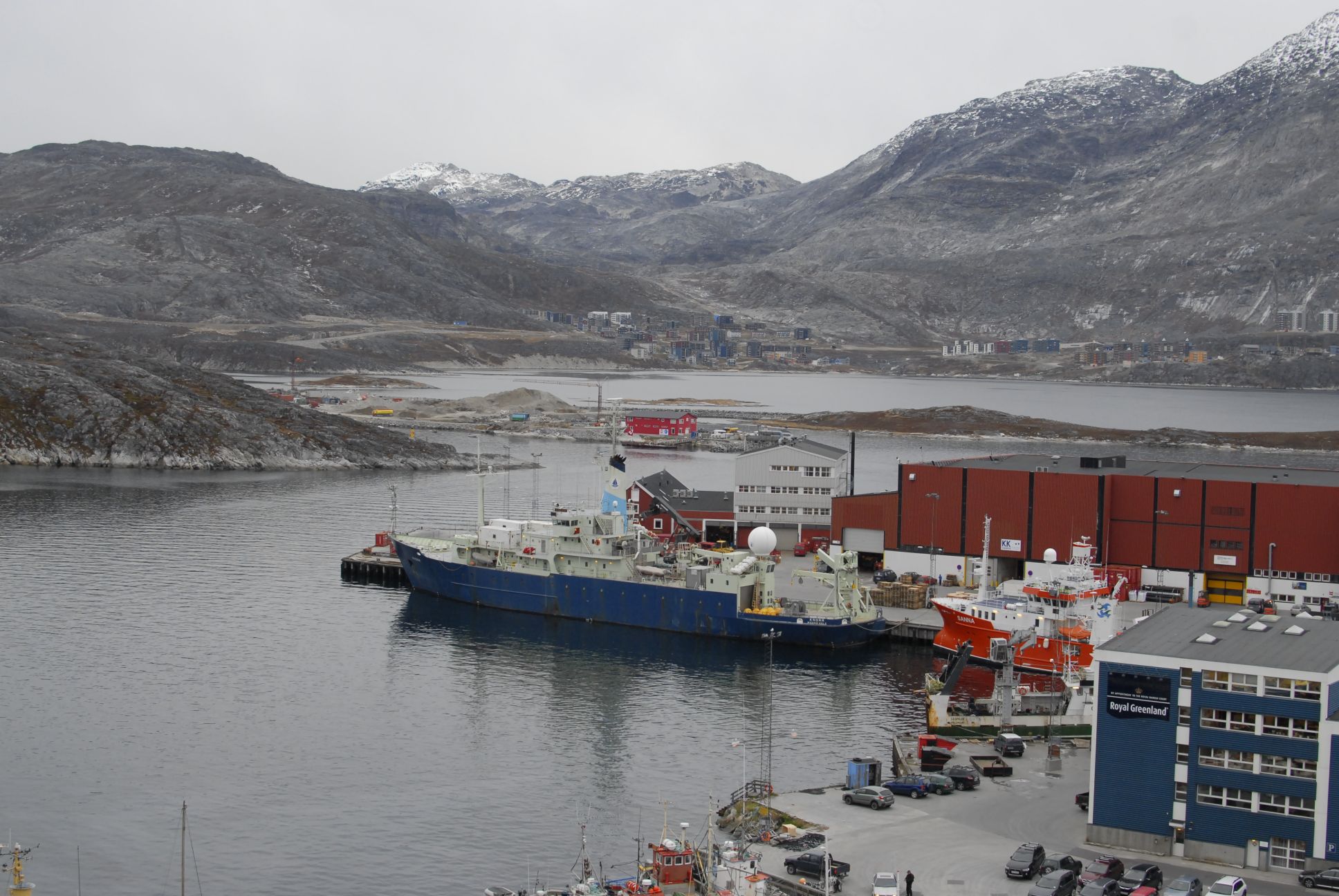
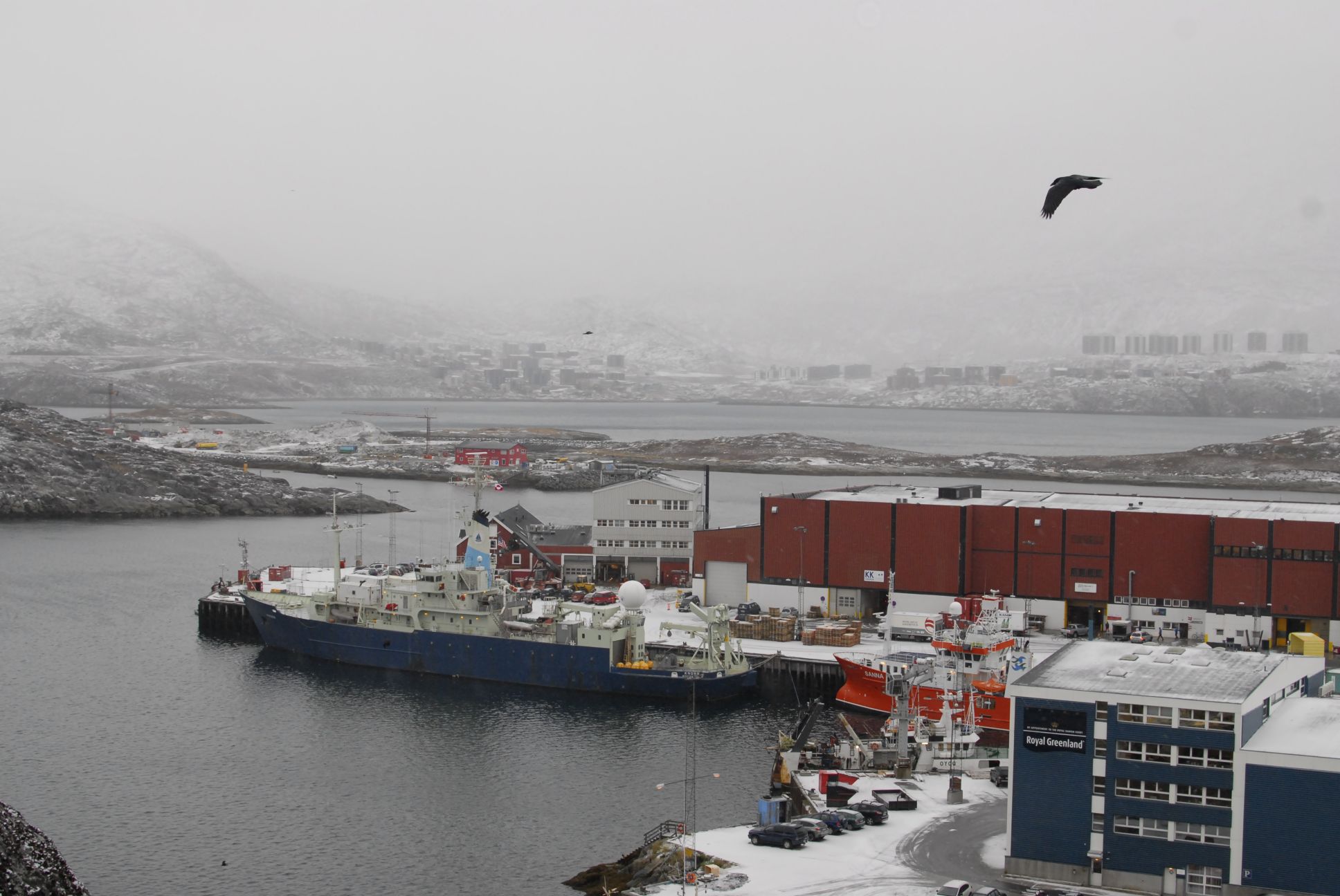
Here she is in the port of Nuuk! She is in the center of the picture with the blue hull. By the way, a ship is always referred to as "she".
While waiting for the cruise to start, I took some time to visit around. Nuuk is a surprising mix of old Inuit traditions and modernism. The town, populated by about 16,000 inhabitants, is the capital and largest city of Greenland. It is located in a fjord on the eastern shore of the Labrador Sea. Life in Nuuk, like much of Greenland, is actually quite expensive probably because of the associated costs of importation to the island. The economy in Nuuk is mainly oriented around seafood but there is also a blooming industry in oil and mineral exploration as Arctic ice is melting.
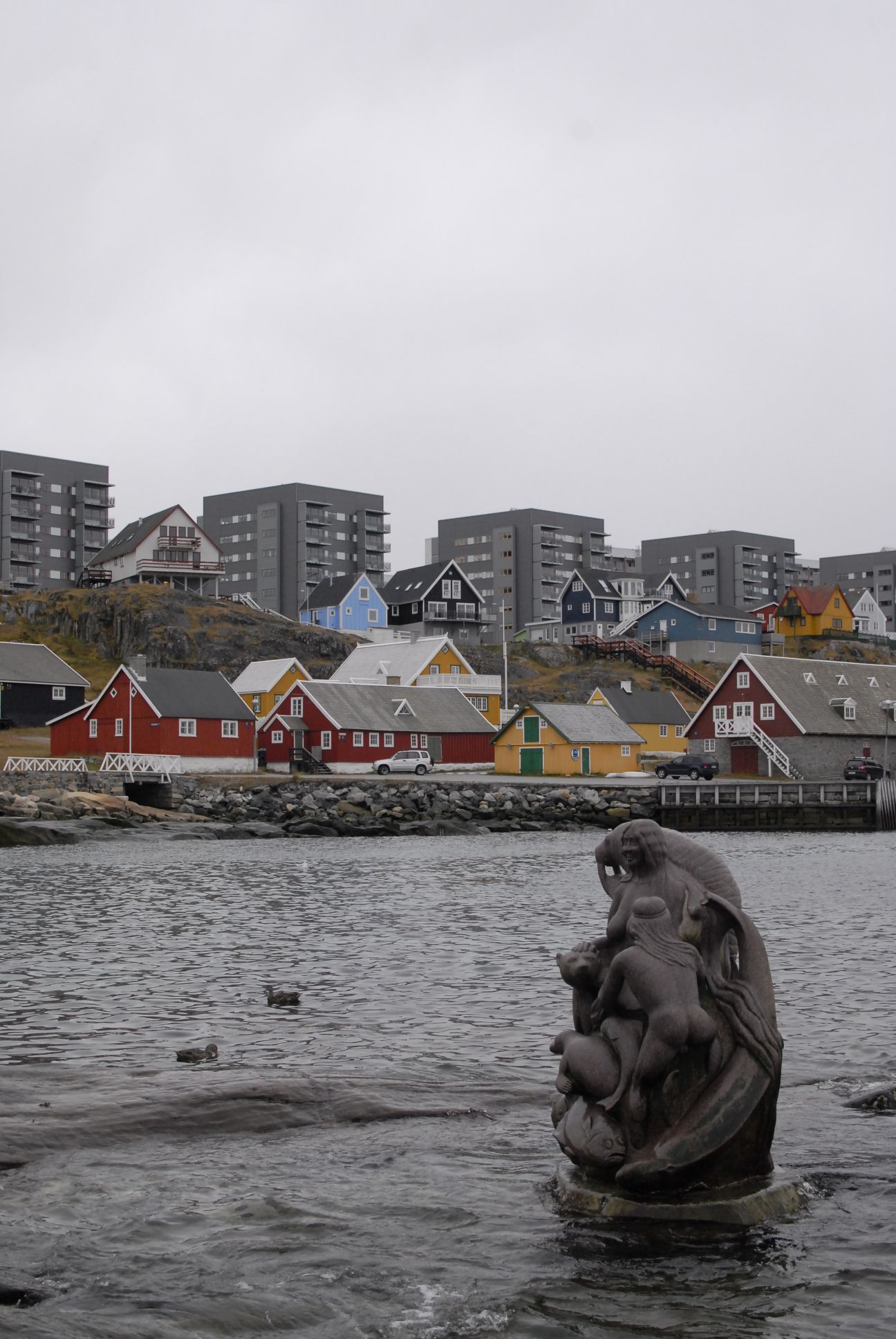
Mixture of old and new.
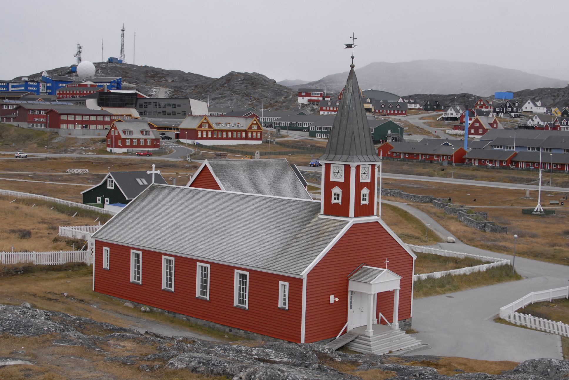
Nuuk Cathedral.
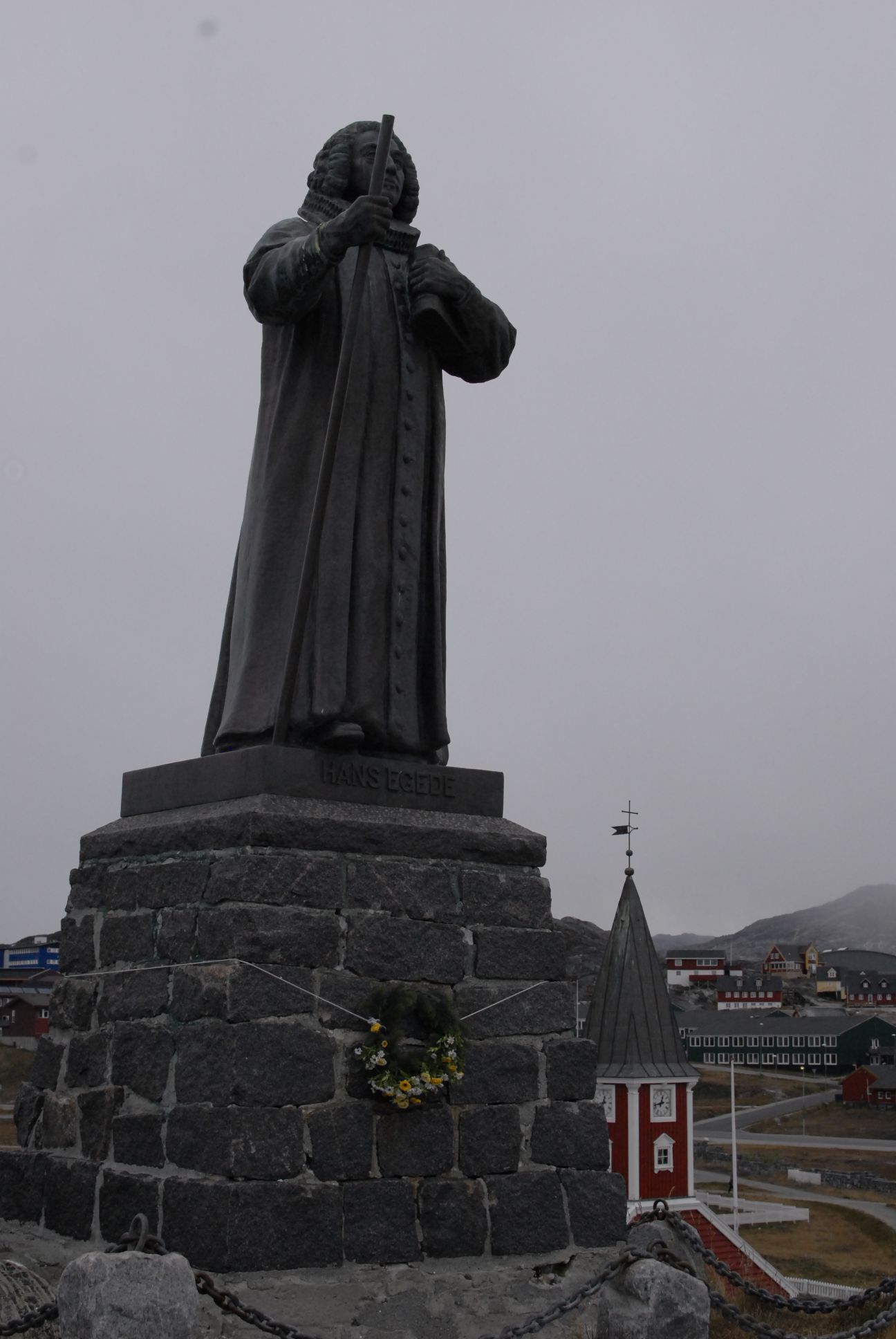
Statue of Hans Egede, founder of Nuuk.
Here is the ship on my way back but with slightly different weather conditions. It started to snow and winds picked up shortly thereafter.
After a couple days in port, we just departed Nuuk at 1000 UTC on Wednesday, October 09. We will then proceed to the southern tip of Greenland and begin a transect leg south along longitude 43W to latitude 51N, west to 52W and finally northeast to the point 58N, 48W. The total distance is approximately 1200 nautical miles (2222km) and will take at least 5 days.
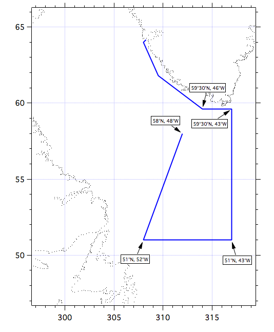
Our sailing map for the next 5 days.
If we find the right conditions for our study, i.e. good gas exchange and strong winds, we will suspend the survey and remain on-station as long as needed. As we currently set sail off Nuuk, we already encountered winds up to 50 knots (26 m/s). Fortunately we are doing some deployment trials within the fjord and we are still somewhat protected from strong growing seas. This is a good starting point to get those sea legs!
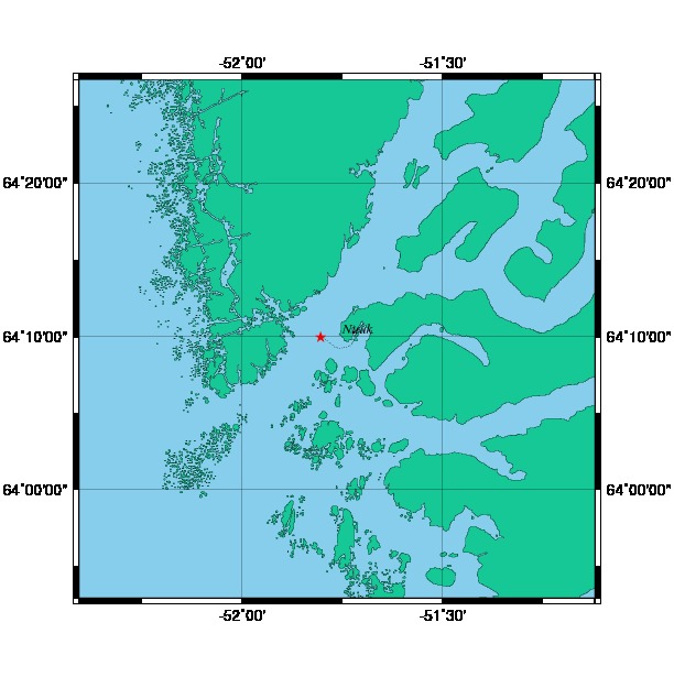
Our current location (red star) as I post on this blog.
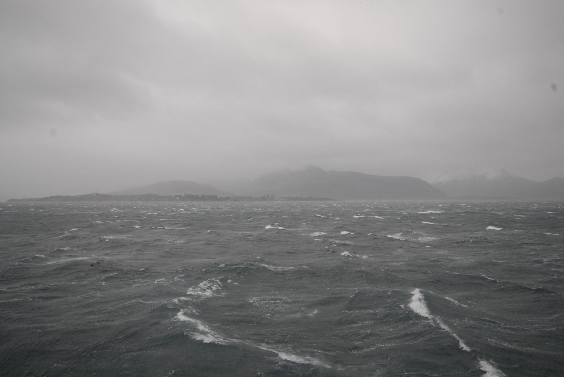
Off we go! Nuuk is in the background.
Alright landlubbers, that’s it for today. I will keep blogging at least once a week or more when possible. If you have any particular questions, don’t hesitate to leave me a comment or send me an email, and I will try to address it in my next post. Happy sailing!