by Matthew Shupe, CIRES/NOAA scientist and co-coordinator of MOSAiC
With a short weather window we had the time to make a quick trip to the L2 site today. That’s where we have one of our semi-autonomous surface flux stations operating. It has been a cloudy day but the clouds are just high enough to provide a reasonable flight altitude below. This trip was kind of last-minute, as these days the conditions are typically not conducive to flying, so we don’t schedule our days around such a trip. But, late morning, the trip was planned. Finding a “bear guard” to accompany was easy; Jonathan heard us discussing plans over lunch and his ears perked up…. Eagerly volunteering to go along. For me it was a fun trip as it was my first time at MOSAiC flying in the front of the helicopter with the pilot.
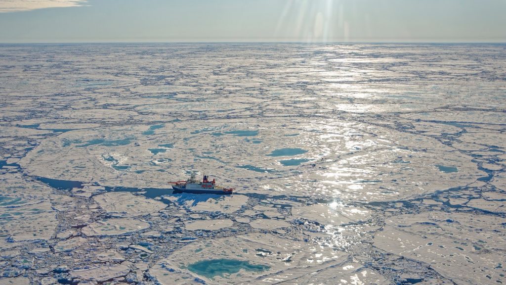
What a remarkable view from the front, with the big windows that look out in all directions. Flying out over this diverse ice pack. One thing that struck me about the flight was the number of dirty ice floes. There are many others like our floe, and some that are much dirtier, black and gray. Landing at L2, we found the scene mostly unchanged from a couple weeks ago. The adjacent ice floe had moved and the edge was different, but all of the major equipment was still intact. Our work was quick, checking tasks off our list for the day, diagnosing problems and making small fixes. Leveling our radiation measurements. Then a bit of work over at some buoys deployed by partners, again leveling them so that the measurements make sense.
But the highlight of the trip for me was the fishing. Not for fish, but rather for ocean properties. A little device for measuring ocean temperature and salinity strung from a motorized fishing rod. I found a nice perch on a large, sloping ice block that leaned out into the lead and dropped the instrument in the water. A slow descent of the device for the first 20m to resolve the interesting details of the upper ocean (including maybe a fresh water layer on top), then a little faster descent below that depth. Down to 250m, at which point the helicopter was on its way to get us….. The motor on the rod made for easy reeling, and within a few minutes the measurement package was back at the surface. That was my first so-called CTD measurement. I guess most oceanographers have done them, just like most atmospheric scientists have launched a weather balloon. A rite of passage in some respects. And now I have a new skill….. and this one was learned in great style, nice and mellow, sitting there on the edge of a lead.