At first glance, this morning seemed to bring another uphill battle for getting a DataHawk into the sky. Overcast skies, light to moderate snow, and winds blowing at 15-25 mph forced us to turn our attention to the wind vane for our morning work. After some work on the vane and going through the required calibration, we headed out to a gravel area near the ARM 10 meter and 2 meter towers to set up an additional tripod that would hold both our wind vane and the sonic anemometer that Sandia National Lab brought along. As we were out setting up the tripod and ensuring our instruments were level, the precipitation started letting up, the clouds broke up a bit, and the winds came down enough that we were comfortable preparing for DataHawk flights!
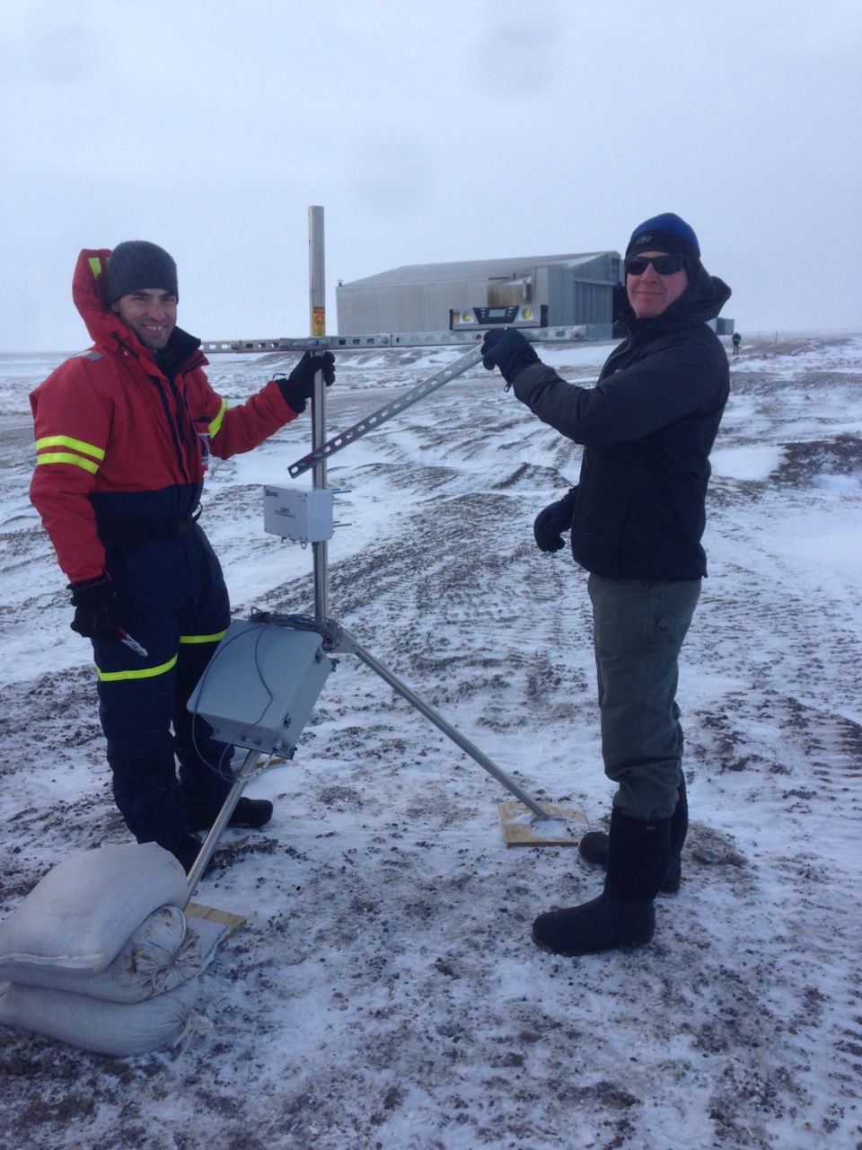
Gijs and Scott work on setting up the tripod for the CU wind vane and Sandia sonic anemometer.
For those not familiar with the DataHawk, the aircraft is launched using a bungee cord that propels it to a high enough speed to become airborne. It’s a fairly easy to use system, though it does require us to drive a stake into the ground. This is easier said than done when the ground is frozen solid! Fortunately, using a small but heavy mallet, we were able to get the bungee system secured, and after calibrating the aircraft we were ready for take off! This first flight went fantastically well, and, as it turns out, was our best flight of the day. After take off and a quick systems check overhead, we sent the DataHawk off to execute a racetrack pattern over the southwestern quadrant of the restricted airspace area. During this time, the wind was only slightly diminished (15-20 miles per hour), but the plane held its own and flew a beautifully executed flight.
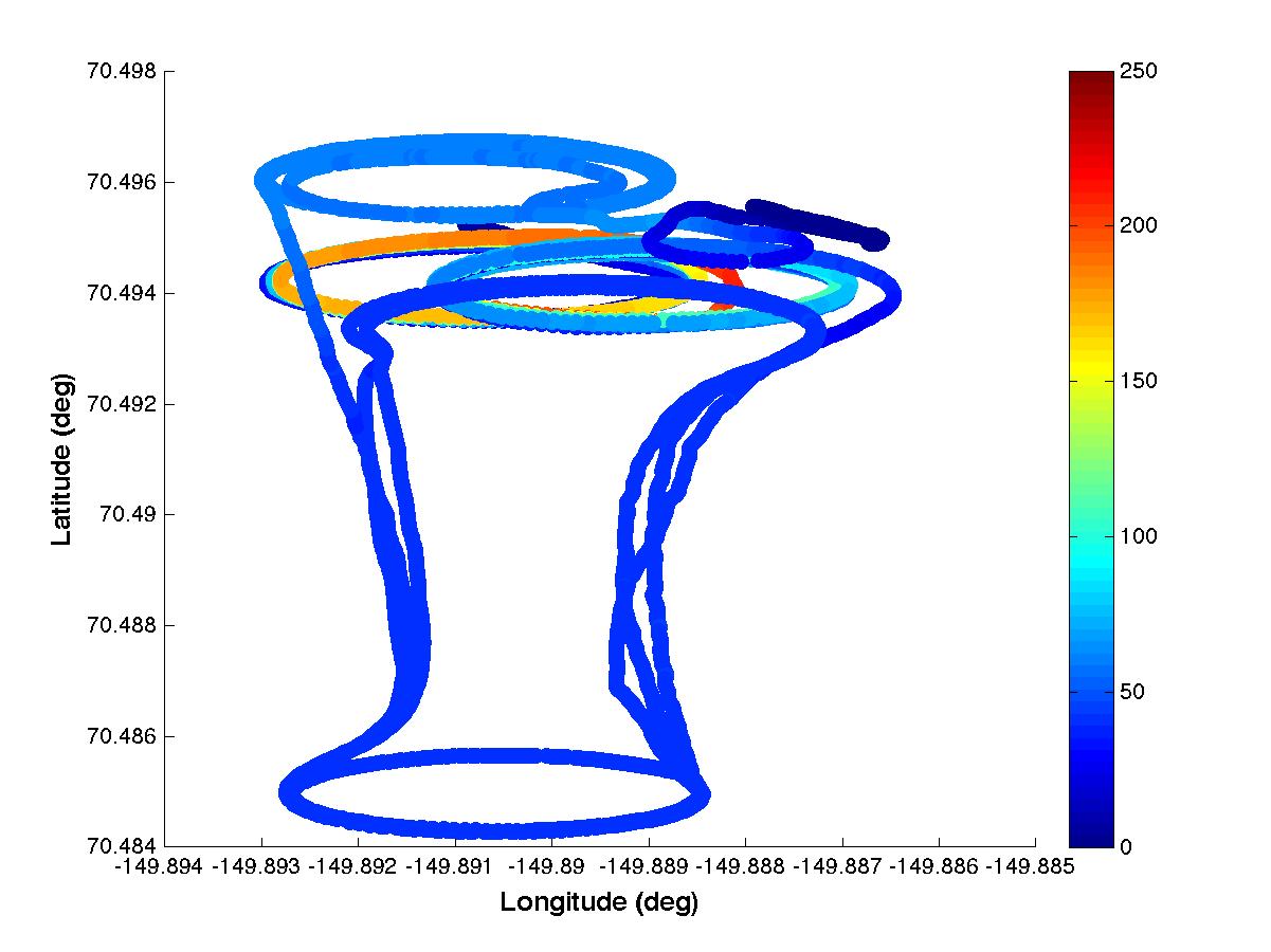
A figure showing the coordinates of our first DataHawk flight for COALA. The colors represent altitude (in meters) above the ground surface.

Jack keeps a watchful eye on the DataHawk while in flight.
We were not the only folks taking advantage of the better weather – the team from Sandia National Lab also launched their tethered balloon system. This balloon is operated from a trailer and can carry a wide variety of instrumentation. Given the wind speeds, the balloon was limited to relatively low altitudes (~250 meters). Toward the end of our flight, we performed two profiles (up to 100 and 200 meters) to facilitate comparison between DataHawk and balloon measurements.
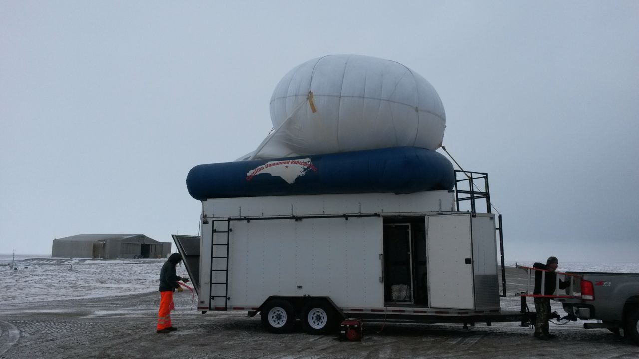
The Sandia team prepares to launch their tethered balloon system on the runway.
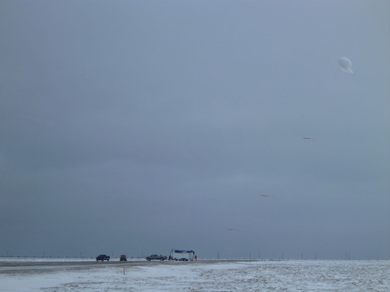
The tethered balloon system in flight.
After a quick battery swap, we attempted to get some more flights in, but an increase in cloud cover and precipitation made aircraft calibration challenging, so our subsequent flights were limited in scope and duration. Given the latest weather forecast, it looks as though our next best opportunities for completing additional flight hours will be tomorrow morning and Saturday afternoon. The hours go by incredibly quickly when the DataHawk is flying (and less quickly when we’re grounded and awaiting better conditions), so I hope that the forecast holds true!