December 22, 2010 was a summer solstice in Antarctica but a winter solstice in the Northern Hemisphere.
I am very happy to announce that we successfully obtained both channels (372 and 374 nm) of lidar data with the Fe Boltzmann lidar from Arrival Heights, McMurdo in Antarctica on December 20th, 2010. And the lidar operation lasted for 48 hours across the summer solstice point (0:48 UTC on December 22, 2010). This is another milestone of the lidar project, although there is still a long way to go to optimize the system.
It took us some extra effort to steer the 374-nm lidar beam into its receiver’s field of view, and we succeeded at the 2nd try on December 20th. Our PhD student, Weichun Fong, then did a nice job of improving the signal levels on December 21st, 2010 using our suggestion to adjust the beam expander. We are optimistic that we can further improve both channels’ signal levels with more work.
Every team member has worked extremely hard, which was especially challenging for the long 48-hour lidar run and test, under such remote conditions. But we were all really happy as we achieved one of our goals — to get both lidar channels up and running by the summer solstice. In addition, I am really happy that our winter-over PhD student, Zhibin Yu, has made significant progress in learning the lidar operation since he arrived on December 9th, 2010. He has taken the shift independently to watch the lidar for many hours.
On December 22, 2010 (in US time, it should be December 21st, 2010), Weichun and I measured the solar angle around the solstice point using a simple method – trigonometric measurement with a rule standing perpendicularly to a leveled surface. The rule length divided by its shadow’s length gives the tangent value of the solar angle. By this measurement we got a solar angle of ~35 deg, which was very close to my calculation as 23.5 deg + (90 deg – 77.85 deg) = 35.65 deg. Checking at NOAA’s Solar Position Calculator, the maximum solar angle for this location is 35.62 deg. This is just for fun — fellow scientists trying to take a little break from our hard work!
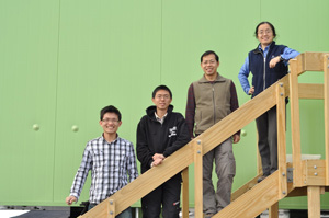
After finishing the lidar operation in the night of December 22, 2010 (local time), the lidar team members on-site took photo shots at Arrival Heights with the Kiwi’s lidar lab. Since it’s solstice, we insist that we must NOT wear the red parkas to show “It’s warm on summer solstice!” From the bottom up, it’s Zhibin, Weichun, Wentao, and Xinzhao.
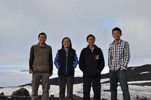
Yes, it’s warm because of the ice on the island and the sea ice surrounding Ross Island! As Melinda informed me, Boulder was colder than McMurdo during this time. Checking with the McMurdo weather station, the outdoor temperature on December 22 did reach above the freezing point.

Around the solstice time, the weather near Ross Island became very interesting. As shown in these two photos, heavy fog came from Mt. Erebus and from the sea surface. Fortunately, McMurdo (the Observational Hill is seen in the left photo) and Arrival Heights were just above the fog so we were able to continue the lidar operation. But the heavy fog at Scott Base (just a few miles from McMurdo) prevented the takeoff and landing of helicopters. A Russian cruise ship came on December 22, 2010, but none of our team members had a chance to meet them as we were either working on the lidar or trying to catch some sleep in the dormitory.
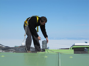
John Smith opening a laser beam tube and the telescope hatch from the roof of the Kiwi’s building on December 16, 2010
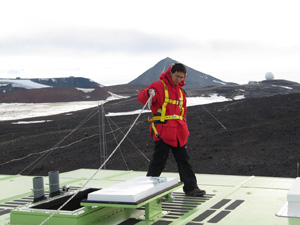
Weichun Fong closing the hatch and beam tubes on December 22, 2010. Both were wearing the fall protection gear. After doing great work on the lidar project, our PhD student John Smith was redeployed on December 17, 2010, i.e., he flew to the north, and by now he has safely reached home in Colorado. But his heart is still with us, as he is trying to help in any way he can. Our best wishes to him and his family!
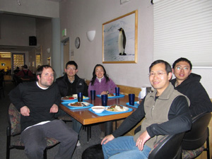
One of the last meals we had with John at McMurdo Galley. A sixth friend was invited to our gathering – the emperor penguin!
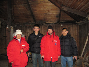
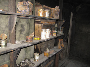
We accompanied John on a visit to the Discover Hut before his flight north. This hut was built by Scott’s expedition team about 100 years ago. We are in awe of earlier Antarctic expedites!
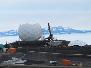
A photo taken in earlier December – the NASA dome in repair. It was given a new name by our lidar team – the broken egg!

A panaroma of the McMurdo Station credited to Wentao Huang who took the photos on the top of the Observational Hill. I haven’t tried to climb the Observational Hill in this trip, although I did it 10 years ago. It’s one of the things on my plate before I leave the station in January. As Zhibin put it, Wentao has quite an artist’s eyes, so I’d like to share this nice image he took with you!
Sincerely,
Xinzhao
