El Niño, where art thou?February 5, 2015by Gijs de Boer (CIRES)
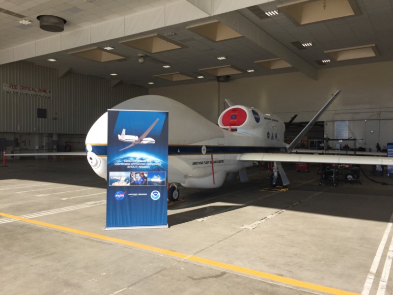
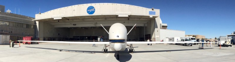 The Global Hawk at the NASA Armstrong Flight Research Center at Edwards Air Force Base
El Niño, where art thou?
February 5, 2015by Gijs de Boer (CIRES)
EDWARDS AIR FORCE BASE, California — A ridge of high pressure has effectively isolated the US from the Pacific storm systems. This weather pattern has made sampling with the Global Hawk less attractive, since the weather systems that we’re trying to get measurements on aren’t happening. This has also raised questions within the news media (particularly here in Southern California) about where El Niño and the stormy weather associated with it are hiding.
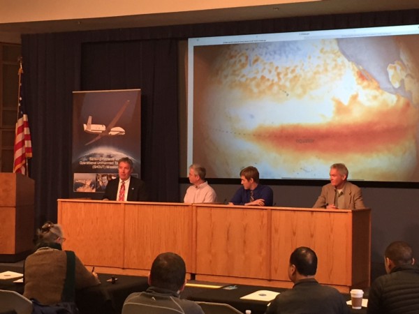
Today, Armstrong hosted a media event to tell the public what it is that we’re doing with the Global Hawk for the SHOUT/ENRR mission, and one reporter raised this question directly.
While the question is a fair one, there are a couple of important things to remember:
1) El Niño is a wide-reaching phenomenon that impacts a variety of weather patterns around the globe. While in general, El Niño conditions result in a wetter, stormier California, that’s not always the case. We know that this El Niño is not a dud, based on the sea surface temperatures observed. However, just how that event ultimately plays out on global weather patterns is something we’re working very hard to understand!
2) El Niño conditions will likely be around for a while to come. As with any large scale pattern, there will always be local-scale variability, even when the large-scale pattern is set up a certain way. While the current ridge may be particularly anomalous for an El Niño year, it’s certainly quite possible that future storms, fueled by the gigantic sea surface temperature anomaly along the equator in the Pacific, will still impact California in the weeks to come. In fact, it was only a few days ago when I was flying into Burbank for this campaign, that there was a significant weather event here in Southern California, with wind and substantial rainfall.
What does all of this mean for the mission? That we need to be patient for a bit longer. It’s true that we’re “on the clock” as far as the campaign goes, so we are exploring options in case the storm pattern doesn’t become more active in these last two weeks. One option may be to more closely coordinate with the G-IV and focus our efforts towards the equator. Another option may be to study the storms that the ridge is now steering directly into Alaska. Ultimately, this is all part of a field campaign — we still (thankfully) can’t control the weather, so we have to make the best of the situation.
For the time being, one positive note about the high pressure ridge: it made for some fantastic weather for media day, allowing me to take some additional photographs of the aircraft!
My shift out here at Edwards is coming to a close — while it would have been great to be a part of one of the 24-hour science flights, I’ve learned a lot about the system and its capabilities during my week here. I certainly hope to do it again in the future!
By CIRES on February 5, 2016.
Exported from Medium on January 12, 2017.